


Timezero Professional
1890,00€
“Timezero Professional is a high-performance marine navigation solution engineered to meet the rigorous demands of professional seafarers. The ideal software to use with our Aqua Compact Pro + PC.”
DESCRIPTION
Timezero Professional is a high-performance marine navigation solution engineered to meet the rigorous demands of professional seafarers. Equipped with industry-leading charting technology and an extensive suite of advanced features, the software delivers precise situational awareness, seamless route planning, and optimized vessel management.
The user interface of TZ Professional is intuitive and easy to use when it comes to managing all your navigation data as well as all the other features which have made Timezero a huge success for more than 30 years.
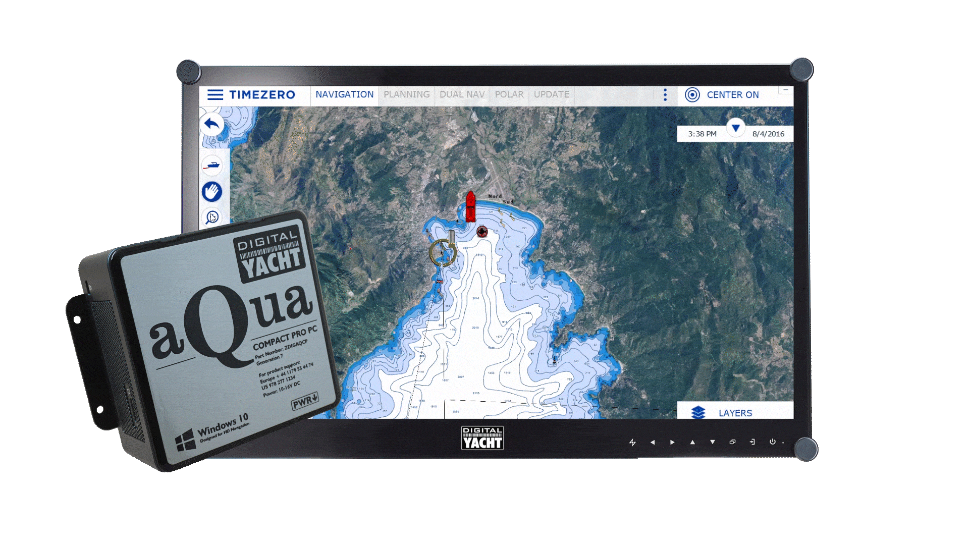
Timezero sets the standard for reliability and control in commercial maritime operations. Digital Yacht’s range of marine PCs and NMEA converters are the top hardware solutions to pair with Timezero Professional. It is ideal for use with our Aqua Compact Pro Plus PC and our range of HD marine monitor.
It’s fully compatible with Windows 10 & 11 and also with our iKonvert USB-NMEA 2000 gateway, USB-NMEA 0183 adaptor and NavLink2 wireless gateways if you want to receive all your NMEA data on the Timezero Professional software.
Delivered as a digital download or pre-installed on our Aqua PCs, it comes with a licence for 1 PC but can be used on 3 screens in the same time. Charts are not supplied with the software.
Discover how Timezero software caters to your needs no matter your activity.
MAIN FEATURES
Chart Engine
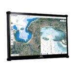
TIMEZERO technology brings you a noteworthy comfort of use and an outstanding power to TIMEZERO software. All our software offers you a seamless and continuous chart display thanks to its revolutionary technology.
The combination of PhotoFusion with an innovative 2D/3D chart engine makes it possible to simultaneously visualize all the key data on a single screen. The navigation is smooth with no redraw time even when using pan and zoom.
Aqua Compact Pro + is the perfect PC for taking full advantage of all the power of the Timezero technology.
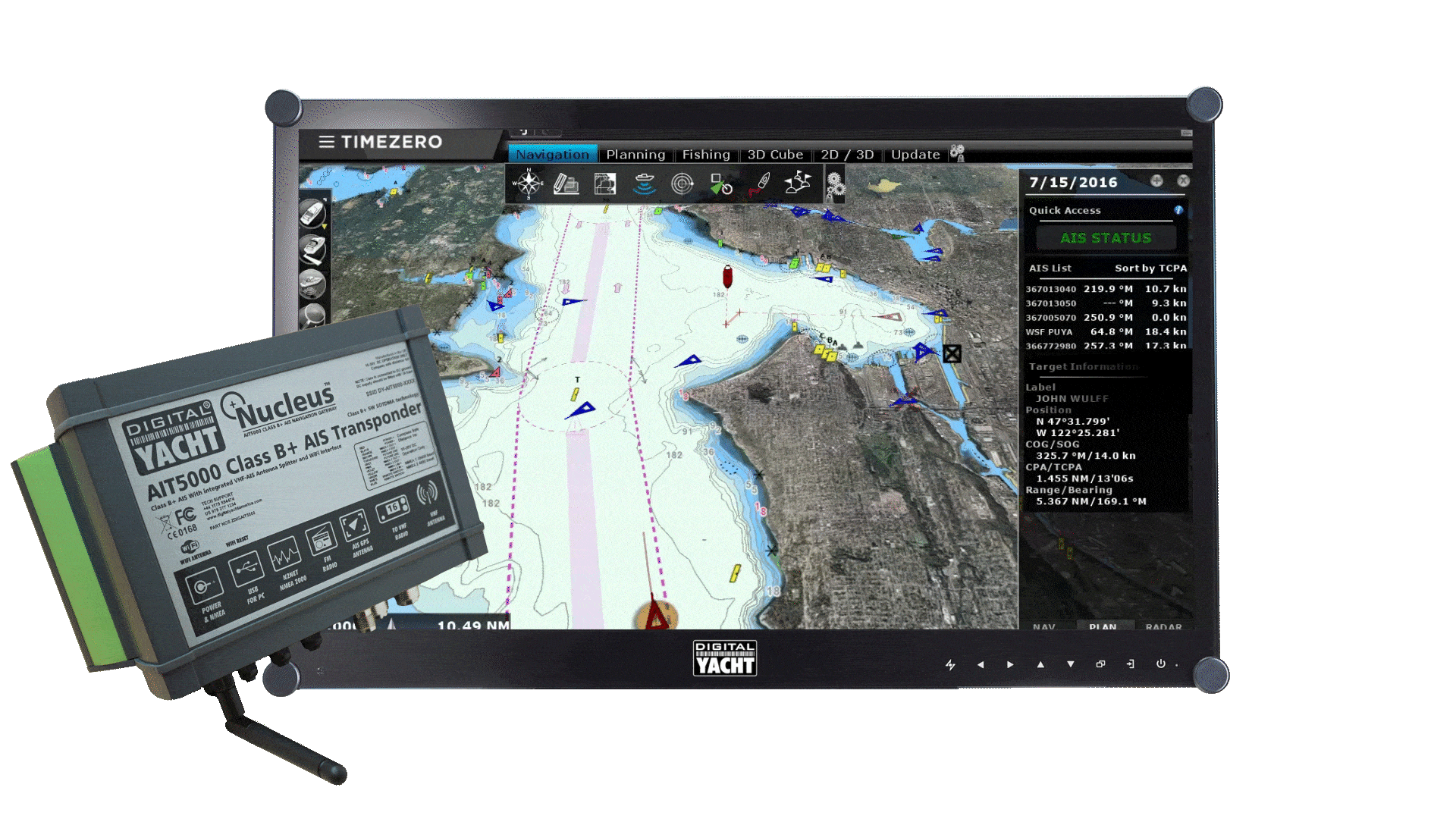
AIS Features
The configuration of AIS can sometimes prove to be complex. The AIS module allows for complete configuration of all information directly within TZ Professional (Status, Destination, etc.). Furthermore, it is now possible to receive and send AIS text messages from TZ Professional. This system will allow for simplified communication, free and individual with all boats which are equipped with AIS.
Finally, it is possible to quickly identify boats that are actively fishing by selecting speed ranges that correspond to the speeds of boats that are fishing.
Check out Digital Yacht’s AIS transponders to display in real-time AIS targets on Timezero Professional.
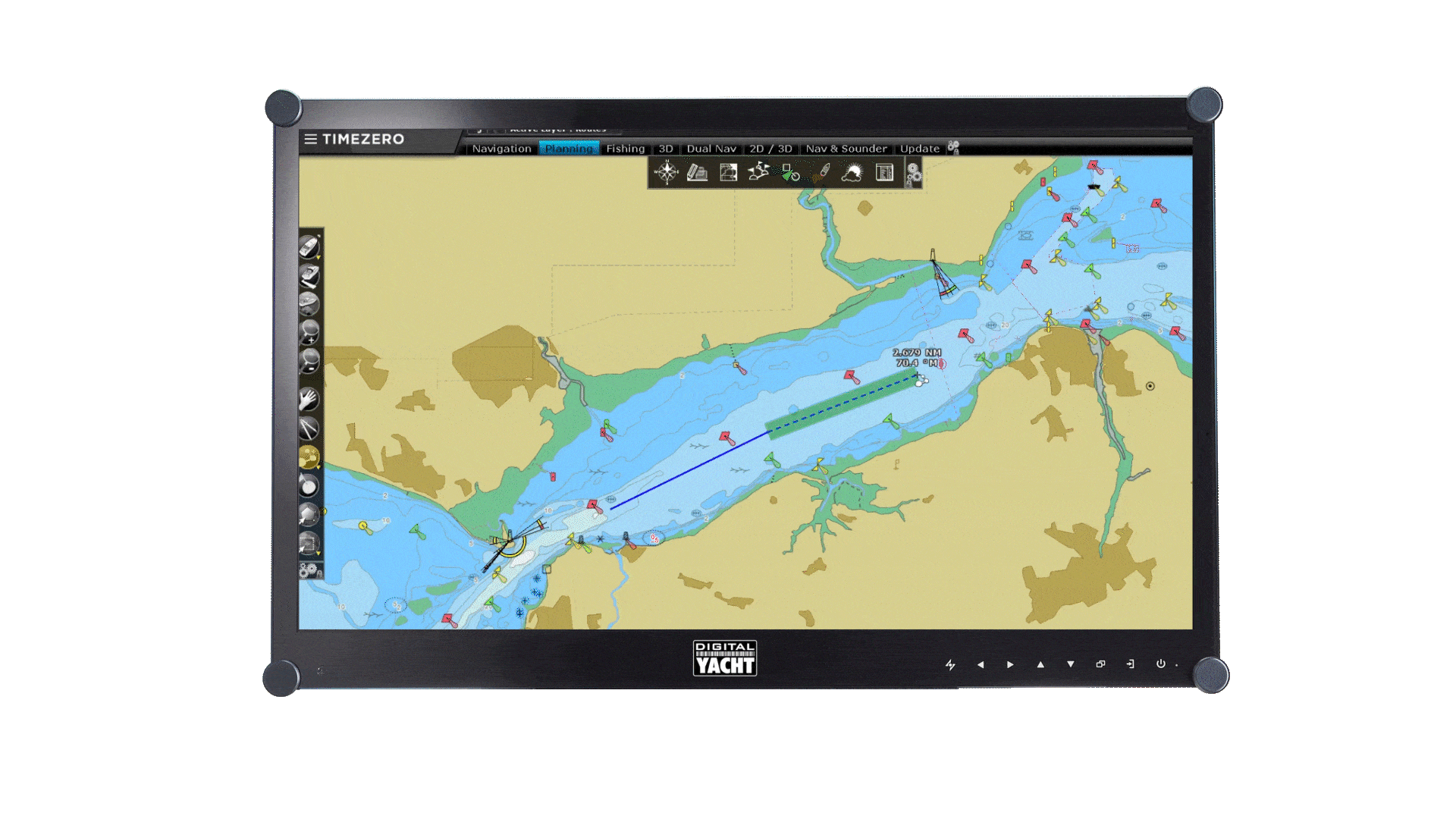
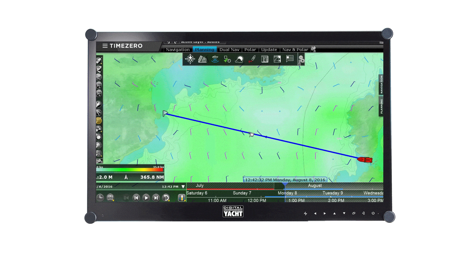
Route Management
Route Planning is of the utmost importance for all professions at sea.
Our new technology assures the security of a route upon creation: Through color codes (green/red) it is instantaneously possible to know if the depth is sufficient for the safe passing of your boat.
An automatic route wizard will provide you with information regarding to the optimal departure and arrival time, taking into account tides and currents.
Use a Digital Yacht NMEA to USB converter or WiFi to connect the Timezero software to your NMEA network.
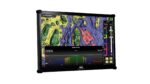
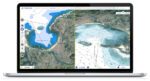
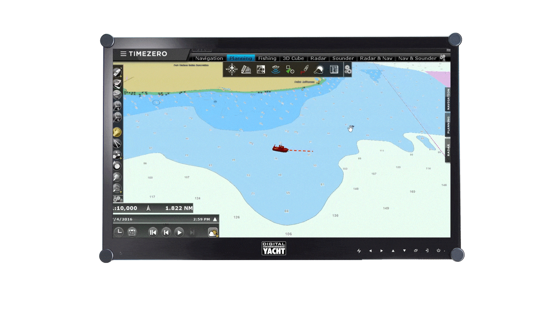
Fishing Workspace
A workspace exclusively dedicated for professional fishermen will allow for personalization of 2D/3D so accessing information that is most pertinent is shown first.
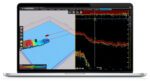
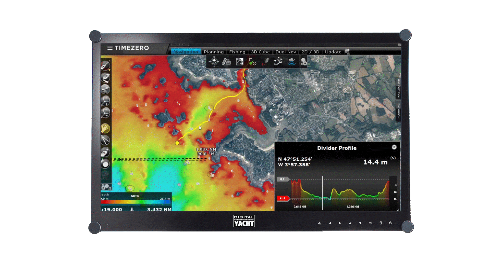
Profile Window
Instantaneously display a point to point depth profile window.
This 2D view will allow you to identify the depth variations with unequalled precision (rocks, shipwrecks, etc.).
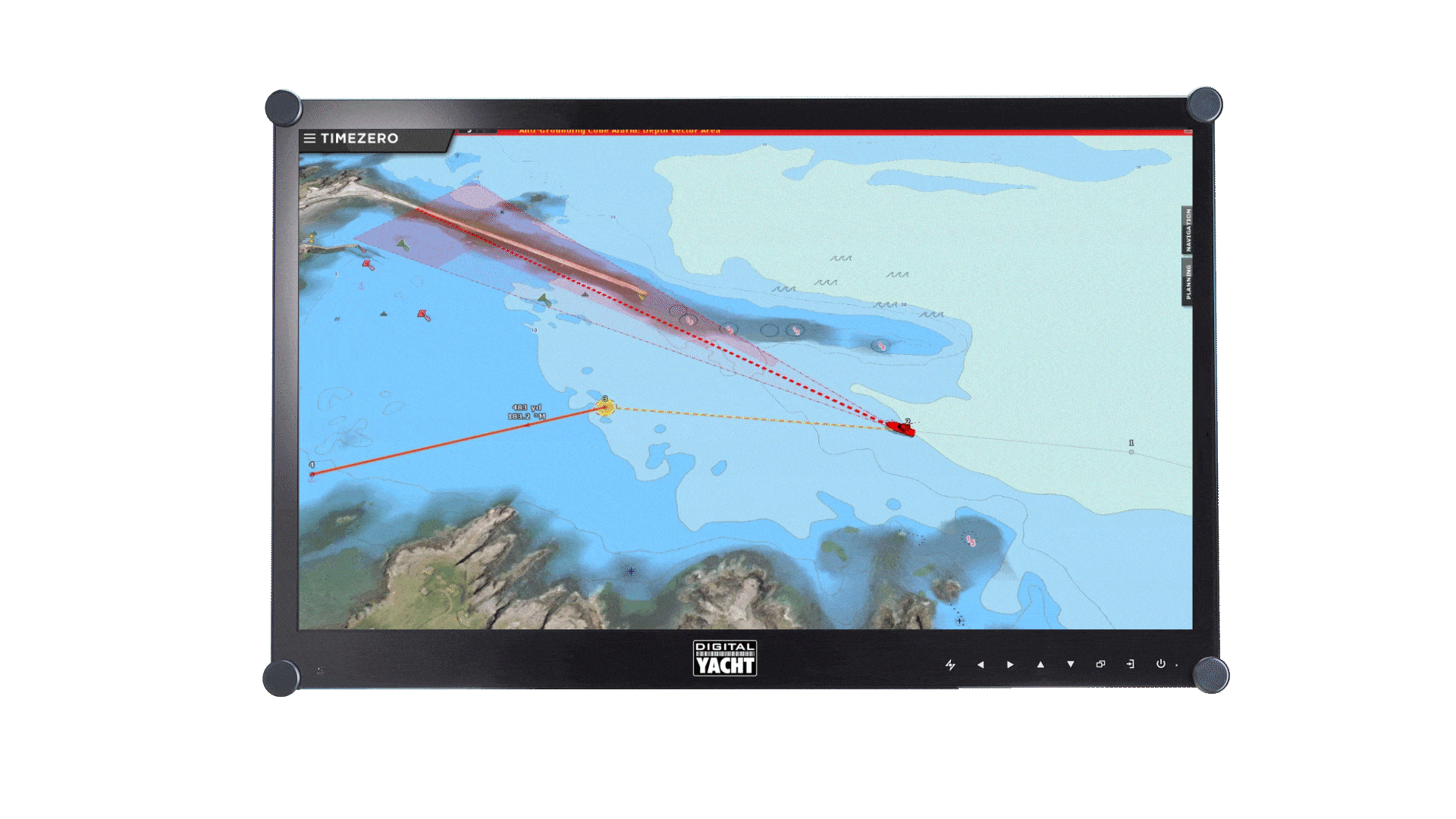
Security Cone
The new security cone is a feature in adherence with the official rules of the IMO. It takes into account the information of vector charts in order to detect isolated dangers and shallow areas.
If an obstacle is detected inside this cone in front of the boat’s trajectory, an anti-grounding alarm will automatically be triggered.
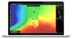
Free Weather Forecast
Because no navigator will plan a route without a reliable weather forecast, TIMEZERO offers free access to updated data to all users. You can download and display weather and oceanic data directly from TIMEZERO Weather Wizard.

An intuitive user interface
The user interface of TZ Professional is intuitive and easy to use when it comes to managing all your navigation data as well as all the other features which have made TIMEZERO a huge success for more than 30 years.
OPTIONAL MODULES (CONTACT US FOR PRICING)
TIMEZERO offers many optional modules to enhance your navigation experience. Contact us if you would also like to purchase a module with the software.

Weather Routing
The Weather Routing module combines with both TZ Navigator and TZ Professional to provide a route that will optimize the time taken to travel on a sailboat using the weather forecast information and your boat’s polars.
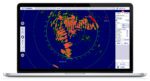
Radar
TIMEZERO software offers exclusive, native compatibility (simple Ethernet connection) with all the FURUNO DRS antennas as well as the commercial series of FURUNO FAR radars.
TIMEZERO can be connected to a Furuno NavNet network allowing full control of the DRS radars (with or without an MFD on the network). This means that you can display the radar image directly in TIMEZERO software, enjoy full control of the Radar from your software, and overlay the radar image on your charts.
The Smart Radar mode uses vector chart information and AIS to discriminate radar echoes, allowing you to focus on “unknown objects” to improve situational awareness.

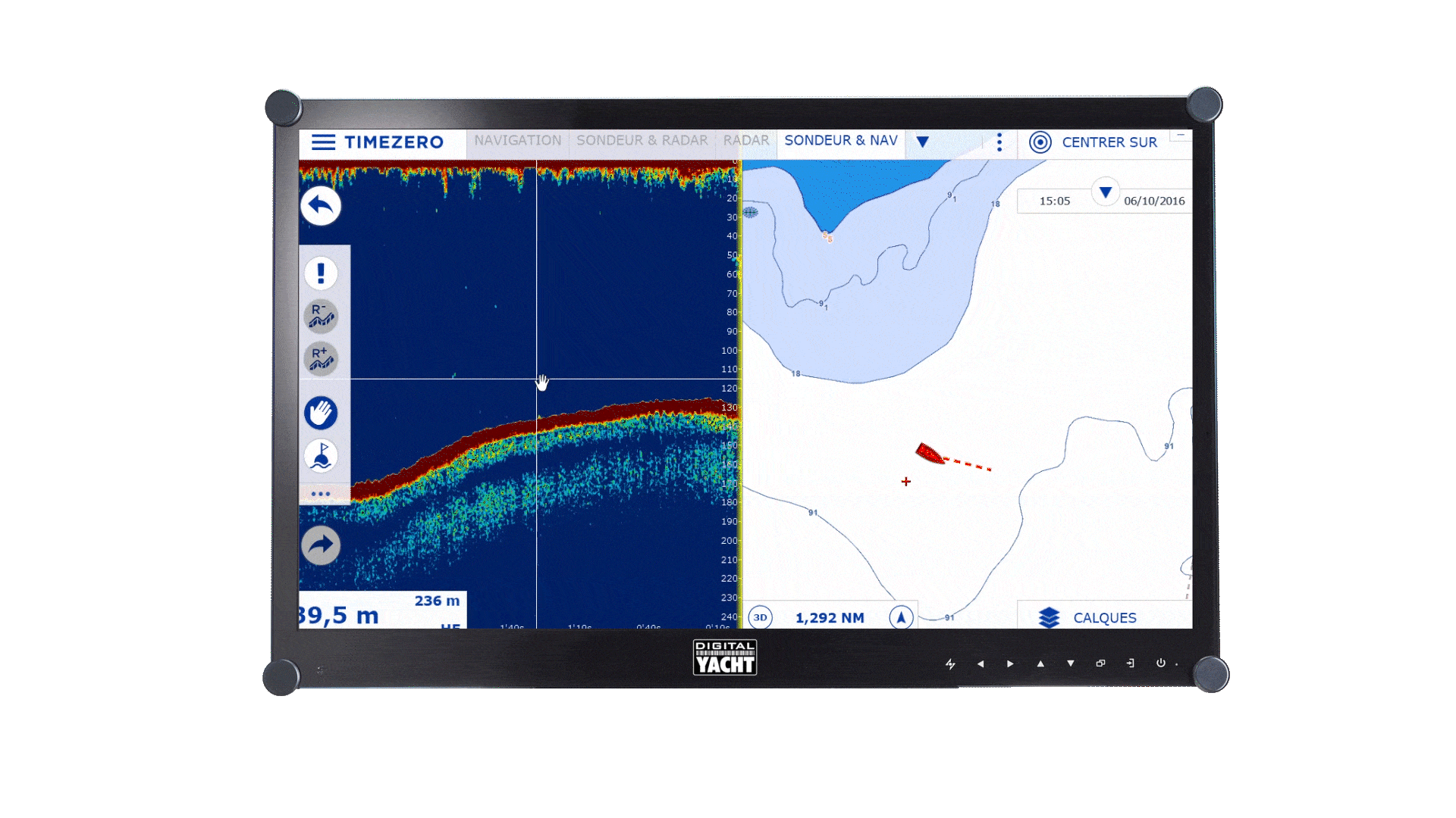
Sounder Module
The Echogram display provides Echo presentation with real time A-Scope thanks to FURUNO’s digital filter technology.
Digital Filter (FDF™) fish finders offer advanced filtering capabilities and digital auto tuning, which eliminates noise, while delivering the ability to spot individual fish with clarity, accuracy and detail.
Compatibility with S-63 charts
Keeping up to date charts is an essential element to ensure the safety of all those at sea. TZ Professional is now compatible with the official encrypted S-63 charts. S-63 charts are updated every week.
These maps respect the S-52 standard developed by the International Maritime Organization (IMO). The iconography offers a simplified display in order to improve the readability of the marine charts on-screen.
VDR
The Voyage Data Recorder Module, that comes as an option, offers the possibility to save all the information received from the connected sensors to TZ Professional (GPS, radar and AIS/ARPA).
It is particularly useful in the case of an incident as it allows one to look back at all the available information relative to the surrounding environment of the boat at that given date and time.

SPECIFICATIONS
- Supported PC Operating Systems: Windows 10 and Windows 11
- Connection to Instruments:
SeaTalk 1 via STN adaptor
NMEA 2000 via iKonvert NMEA 2000 to USB or NavLink
NMEA0183 via USB-NMEA adaptor - Supported PC Operating Systems: Microsoft® Windows® 10/11 (64-bit operating system)
- Autopilot Output Connection
- Exclusive TIMEZERO Chart Engine (2D and 3D View with Seamless Chart Redraw without limited range presets)
- Advanced Professional User Interface
- “Quick Action” NavData allows configuring any actions to a button
- Day, Dusk, and Night Mode
- Worldwide Planning Charts (base map)
- Worldwide 3D Database (base map)
- Worldwide Tide Database
- Tidal Currents for North America
- TZ MAPS compatibility (Vector, Raster when available, detailed land information, high-resolution satellite photos, and high-resolution Bathymetry)
- mm3d Raster or Vector chart compatibility (from various manufacturers such as C-MAP or MapMedia)
- Accurate mm3d High Resolution Satellite Photos for Bahamas and Europe
- Exclusive TIMEZERO PhotoFusion (intelligent mix of satellite photos and nautical charts)
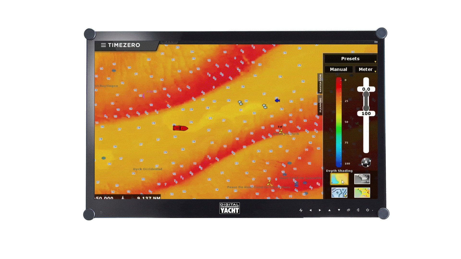
- Depth Shading (color according to depth overlaid on the chart)
- Multi-level Undo & Redo
- Unlimited Track Recording (with track recall feature)
- Track Line Coloring (according to SST, Speed, Depth, etc.)
- Advanced Route Planning Wizard (Route Departure Time Optimization according to Tidal Current)
- Search & Rescue (SAR) Route Patterns
- Anti-Grounding Cone
- Planning Route Safety Check
- Lost Sensor Alarm
- Print Route Feature
- Odometer NavData (Duration, Distance, Max Speed, Average Speed)
- Marks, Waypoints, Routes, Boundaries, Lines, Annotations & Photos (User Objects)
- Synchronization of User Objects (Local and Cloud synchronization among compatible TIMEZERO Platforms)
- Unlimited Marks, Tracks, and Boundaries
- Layer and Marks Management (including presets to create “groups” of layers)
- Advanced Events Management
- Event NavData (allows quick event placement with mouse)
- Loran C & Decca Grid
- Worldwide Place Name Search
- Import your own Photos with Automatic Geolocation
- POIs: ActiveCaptain (Interactive Cruising Guidebook)
- Weather Data Service (Rain, Cloud, Air Temperature, Wind, Waves, Oceanic Currents, Pressure)
- Ocean Data Service (Sea Surface Temperature, Plankton, Altimetry)
- Weather Forecast, Tides, and Currents Animation
- Alarms: Anchor Alarm, CPA/TCPA Alarm, Depth Alarm, and more
- Alarm Zone NavData (see closest alarm zone at any time)
- Own Ship and Targets (AIS and ARPA) Alarm Zones
- AIS Fishing Mode
- AIS and MARPA Target Display (with targets list)
- AIS and MARPA Graphic CPA
- Target Track Recording
- Automatic Target Trail
- Advanced AIS Management (Target Activation)
- AIS MKD (set Voyage Data and Navigational Status like Moored, Navigation, etc.)
- AIS messages: send/receive addressed “normal” and “safety” messages
- AIS Marine Traffic compatibility (global AIS feed via Internet)
- Digital Selective Calling (DSC) and Man Over Board (MOB)
- TRIPS Feature
- Fleet Tracking (“PosRep” file support)
- Fishing Buoys
- Dual or Triple Monitors Extended Mode
- Fuel Management (Fuel Range Ring, Route Warning, Distance to Empty, Time to Empty)
- Optional: Western European High Resolution Tidal Current (refer to chart catalog for availability)
- Optional: Premium Ocean Data Service (Higher Resolution, Multi-Layer Data, and Custom Filters)
- Optional: mm3d High Resolution 3D bathy (on selected areas only)
Discover TZ Professional
TZ Professional PBG Module
High Resolution Oceanographic Forecasts by TIMEZERO
TZ Cloud | TIMEZERO
FURUNO ecosystem
Augmented Reality | TIMEZERO


